WA Showcase: More than any other Australian capital, Perth is a city designed for cars – a philosophy built on a fundamental misunderstanding of Western Australia’s climate and lifestyle. But can Perth’s freeway-centric design adapt to a growing city and a warming planet?
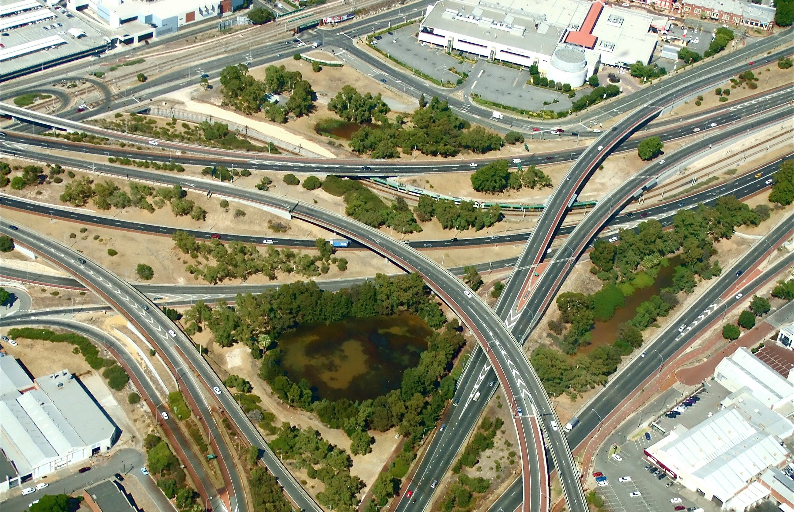

In 2006 the Roe Highway was extended, across reserves and with a trumpet interchange connecting it to the Kwinana Freeway in Jandakot. Along the years little upgrades have been added – a diamond interchange over the Great Eastern Highway in 2012, raised bridges over the Tonkin Highway in 2014. It’s all across stolen land.
There’s plans for an ongoing extension through to Coolbelup, what’s known as ‘Roe 8’ – the intention being to divert freight trucks bound for Fremantle Port, thus relieving traffic congestion elsewhere. In its way are the Beeliar Wetlands, two chains of wetlands that cover 25 kilometres of Perth’s coast, essential to our beach town vibe and home to several endangered species. They’re irreplaceable and make up a significant amount of Perth’s public open space.
Following protests and a change of government, the Roe 8 project has been halted for now – but it’s a stopgap with no legal oversight, and the Roe is like a beast that can be temporarily routed but never truly defeated. Already the highway creeps forward into the edges of Beeliar. The Roe is asphalt and bitumen, sand and minerals from our domestic deserts and the destruction of trees that have grown there since before the land was colonised by the British.
It’s hideous, and it’s beautiful in form.
It’s functional, and it’s necessary, and it should never have been built.
*
Popular parlance talks about Perth as a city designed for cars. Perth is 150 kilometres north to south, with the sun beating down most days on stretches of sandy highway unlined by remnant vegetation. The buildings of the Perth metropolitan area have been heavily influenced by 200 years of European settlement and colonisation. Its open areas were designed to reduce congregation and protest. Its buildings hark back to a colonial past, and conjure a longing for what never truly was. Perth’s complicated history with Public Open Space and its traditional dependence on roads and coal have cut deeply into the landscape. The region’s beautiful coastline of native vegetation has been fragmented, made vulnerable to pests and fire, and continues to decline. As a result, Perth is a bit of a heat island. And so getting about in the flexible air-conditioned pods of cars and buses seems the best solution.
Perth is a bit of a heat island – and so getting about in the flexible air-conditioned pods of cars and buses seems the best solution.
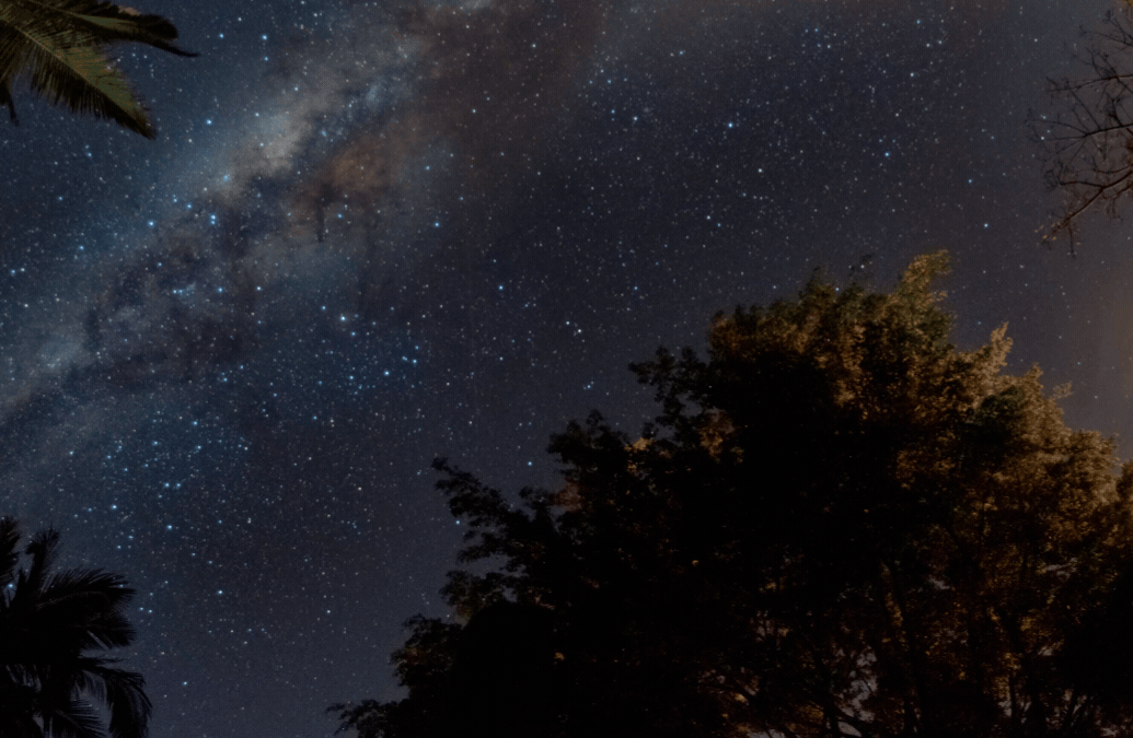
But how did we get this way? Our rivers are soft and inviting, gentle; the remnant bushland is shady and verdant the entire year. Sun is so embraced that some days the amount of electricity being generated from home photovoltaic panels is enough to overwhelm the state’s electricity grid. Walking is a pleasure in areas like Fremantle; the train clacking down the Kwinana Freeway is a speedy delight. But why are these opportunities so few? Why is Perth condemned to spaghetti junctions and six lanes of bitumen?
My life has been constant construction and infrastructure, from my childhood in Perth’s foothills to my adulthood in Perth’s city centre, watching the slowly rising buildings and the roads spreading like rhizomes of couch grass in a water-hungry lawn.
The answer to this is as complicated as it is simple: World War II ended, and some white guys looked at where they sat in the world and decided what was best. They brought a British guy to Perth, the most isolated capital city in the world, and asked him to build an American city.
*
Coming out of World War II, Australia as a whole turned its gaze away from England and across to America for guidance on how to shape the growth of its cities. The American car-centric culture was increasingly being exported around the world, creating wonder and evoking ideas that super-highways and flyovers were like ‘magic carpets’ that could bring Australia to the cusp of big things. The ever-present cultural cringe meant that local, Australian advice was not to be considered or trusted on its own.
They brought a British guy to Perth, the most isolated capital city in the world, and asked him to build an American city.
In 1953, British-born architect Gordon Stephenson travelled to Perth at the invitation of the Western Australian government. Town planning legislation had existed since 1929 but was proving inadequate for a growing Perth; Stephenson, experienced in many foreign cities, was considered an embarrassingly perfect solution. (In a letter to his wife, Stephenson noted that the Lord Mayor ‘tried to make out that I was the only chap on the globe that could help the poor, struggling West Australians’ – a perfect description of how Western Australians see ourselves compared to the world and the rest of Australia.) Together with Queensland town-planner John Hepburn, he created the plan for the Metropolitan Region of Perth and Fremantle. Adopted in 1955 and still largely adhered to in 2018, the Stephenson-Hepburn plan has dictated the shape of Perth’s growth for 70 years – and the shape of my own obsession with transport infrastructure and the unfolding of our city.
Growing up in Perth’s outer suburbs, commuting was a way of life. My father drove 30 kilometres every day to get to work, in some direction or another; my train took me 15 kilometres in another direction. Visiting my best friend took driving 25 kilometres along the Roe south – when the extension opened, it saved me ten glorious minutes. Every addition to Perth’s infrastructure changed my daily routine.
The plan was a product of its time and came about in a uniquely Perth way, starting with the construction of the Narrows Bridge, connecting the CBD with the southern expanse of the growing Perth metropolitan region. This bridge was to span across the narrowest part of ‘an expanse of shallow water which is more or less stagnant for a great part of the year’. This stagnant mass of water is also known as Derbarl Yerrigan, or the Swan River, and Mounts Bay, where it borders Kings Park, is the biggest inner-city national park in the world.
For the Stephenson-Hepburn plan to commence, for Perth to be created in the mold of a modern city, for cars to cross from south to north, Mounts Bay needed to be reclaimed.
Reclamation is a euphemism for when sand is trucked in to change the landscape. It usually involves the removal of sand from one place to another. In the case of Mounts Bay, this was 3.4 million cubic metres of beautiful river sand to be dredged from Melville Water and dumped at the foot of Mount Eliza. It would reduce the Swan River by 60 acres.
It was not the first waterway to be sacrificed to progress. Many of Perth’s lakes and wetlands, rivers and estuaries have been cannibalised, drained and damaged for this ad hoc, economically inefficient and environmentally destructive city. Those that have remained or survived have struggled, with poor management leading to nutrient suffocation and the significant decline of bird and mammal species.
It was not the first waterway to be sacrificed, but we have largely forgotten it was ever more than it was.

In the 1950s, when oil exploration moved into the West Kimberley, oil companies paid in full for the exploration roads constructed by Main Roads. Completed in 1955, the Kwinana Refinery Agreement included the building of 1000 state homes, the provision of all utilities and the construction of a closed access road from Perth to the Kwinana Refinery, an early precursor to the Kwinana Freeway.
The growth of Western Australia’s mines has impacted more than just Perth’s roads; it’s impacted housing costs and food prices and almost every industry. In WA, the hospitality industry grew by 139 per cent between 2004 and 2015. The real estate market also grew over this time and ultimately suffered from the same prick that burst the mining industry bubble. Rental prices in 2018 are 31 per cent lower than they were at their peak in 2013.
The growth of the mining industry saw an increase in discretionary household spending. As hospitality, real estate and related industries are where discretionary household spending is dispersed, the peaks and troughs of it are considered volatile, reacting to shocks. There is no sturdiness, no robustness, to growth built on a mining boom. It takes years to recover. Years to fill those empty houses.
Many of Perth’s lakes and wetlands, rivers and estuaries have been cannibalised, drained and damaged for this ad hoc, economically inefficient and environmentally destructive city.
There’s a new highway being constructed through Perth’s northern suburbs. The Northlink extends out through the Swan Valley and to Muchea, where one day it’ll become a part of the bypass to Darwin.
*
The Stephenson-Hepburn plan suffered in part because Stephenson, coming from England, made assumptions about the recreational lifestyles of people in Perth, based on his own experiences in cooler climates. In England, the outside is for trees and cricket; he neglected to account for backyards and footy ovals and outdoor tennis courts or 40-degree summers. He made assumptions about the history of the land being developed: in London it was industrial land and in Perth it was primarily agricultural. He was unable to recognise the need for preserving high quality remnant bushland in developments and corridors, providing no preservation quality index.
Stephenson acknowledged the common maxim that Public Open Space should be 10 per cent of land development, or one acre per 1000 habitable rooms. His error, though, was assuming that backyards in Australia would be bigger than in the UK, while houses remained the same. As such, he revised down the requirements to half an acre per 1000 head of population. These assumptions regarding density and quality of green space have led to a sparseness in public open space, which has had an impact on the size of roads and verges. Even Hepburn, the Australian half of the Stephenson-Hepburn plan, came from Brisbane, a city whose infrastructure was more firmly in place before World War II, and only immigrated there from Britain in 1951. And so despite these assumptions being critically ill-informed to the final plan, they have remained largely unchallenged for decades and created a precedent for ignoring local environmental and social needs in favour of bitumen.
Ignoring the climate impacts, the impenetrable heat and the size of roads in Perth means that the separation and decrease of Public Open Space, the cutting of trees and the destruction of bushland under this incorrect 10 per cent exacerbates the problem and increases the mentality that cars and roads are the best – or indeed the only – way to get around in Perth.
Despite these assumptions being critically ill-informed, they have remained largely unchallenged for decades, ignoring local environmental and social needs in favour of bitumen.
*
One thing the Stephenson-Hepburn plan did make space for was railways, with two proposed passenger rail lines to Whitfords and Morley. But government interpretation of the plan, then, now and in-between, has consistently viewed the railway component as unnecessary. The Perth Regional Transport Study of 1970 found railways to be less flexible than buses; and so successive governments purchased the lands noted in the plan for roads, but didn’t bother with the lands noted for open public space and rail reserves or, where it did purchase such lands, earmarked them for widening of the highways.
This planned car dependence led to the gentle decline of rail infrastructure, to the point where the Fremantle line was closed down in 1979 and replaced with buses. This came on the assumption that buses, along with cars, offer more flexibility. This is only true from a certain point of view, not allowing that buses move less quantities of people, at slower speeds, with more frequent stops.
Today there are more suburban railways in Perth than there were in 1979; some of them are even according to the Stephenson-Hepburn plan.

It doesn’t seem like much to talk about reduced remnant vegetation, disconnectedness in native vegetation and breaks in greenways. But depending on the size and percentage of tree canopy and ground cover, temperatures can vary by up to nine degrees Celsius from suburb to suburb across Perth. CSIRO research has revealed for every 10 per cent increase in tree canopy cover there’s a 0.62 degree decrease in land surface temperature. It’s a few degrees cooler in the western suburbs and the hills than it is in inner, more built up areas. And it’s not just tree cover that makes a difference; it’s the sacrifice of Perth’s waterways, it’s the need to cover Perth in roads.
It doesn’t seem like much, but if you take that across the entirety of Perth, across the whole of a city, across the whole of a planet – it’s getting hotter, and in Perth, we’re losing everything that will keep us insulated from the changing climate.
*
Northlink is many dry, treeless kilometres of half-connected bitumen across lands stolen from the people of the Whadjuk Noongar nation. The Gnangara Pines have been razed and the bushland has been left untended until the land could be reclaimed for bridge and road. It is a different shape from the landscape I grew up with, and still my heart flutters as I see the curving bridge in the distance. Back in Perth for the first time in months after my father passed away, I call friends to scream in delight about the new road, and watch on my phone slow motion gifs of the gargantuan roundabouts that connect the Tonkin and the Reid into this abomination.
I leave for dinner with my family, half an hour late, having lost an hour to exchanging stories with friends over the pros and cons of this new infrastructure. My father introduced me to these roads; he taught me to navigate them, and I think he wouldn’t have minded my tardiness. After all, he lived through the transition from tiny closed roads to major freeways and he loved them.
It doesn’t seem like much, but [the planet] is getting hotter, and in Perth, we’re losing everything that will keep us insulated from the changing climate.
We have all driven the long commutes from Perth’s CBD and into the reaches beyond the Metropolitan Area. Despite my years of working in environmental sustainability and our enthusiasm over bicycle commuting, despite my de facto disagreement with a city so pedestrian unfriendly, I know the reasoning for the millions spent on this road system and it’s hard to disagree with it.
Perth grew through the first decade of the 21st century, a continued boom that reflected the dream of the Australian middle-class in easy reach: a giant house, a giant yard, a backyard pool and a double-car garage. To accommodate the size of the dream, Perth’s suburbs stretched ever farther north, south and east; better a giant house an hour’s drive from the CBD than an apartment half an hour’s walk.
Car usage in Perth increased from 1 car per 4.9 people in 1953, to 1 car per person in 2016. That figure includes children.
East Perth was an area redesigned for young professionals fifteen years ago. Those young professionals have now become young families who, with no schools or childcare facilities ever having been planned for an inner-city area designed for fly-in, fly-out lifestyles, have had no choice but to be pushed into the suburbs.
The suburbs are infilling, losing tree cover mostly from private land as it’s subdivided, four houses squeezed into the space of one. Arguably a more dense city is a better city – bringing us closer together will ostensibly reduce our dependence on cars and roads – but when a city is designed on the assumption that green space will be taken care of by backyards and private rather than public space, the struggle against planning decisions that take away the trees for the good of more construction feels like a thousand individual battles being lost, one at a time.

What does this mean for Perth in a time of climate change? The latest CSIRO projections see Perth’s rainfall decreasing whilst the rest of the state holds steady. In a city that has lived through drought and now has a water supply 50 per cent desalinated, this is surmountable. Average annual temperature will increase no matter how governments act on emissions. The lack of trees, and vegetation and the roads we continue to build will just enhance Perth as a heat island.
Perth will hold fast to its beautiful beach lifestyle. What else can it do? The beaches are beautiful and the water glistens, even as the coasts erode. The rivers are no good to us; we have already consumed them and stolen their sand. Some towns north of Perth have already lost gazebos and community buildings to storms and coastal erosion. Perth’s waters will rise by 25 centimetres over the next eight years; this could mean the reclaimed land goes under. Mounts Bay Road, Riverside Drive, South Perth, the Governor’s gardens are all critical parts of Perth’s road infrastructure, and are all stolen from the river, which will claim it back.
At Kwinana, the city still spews electricity made from coal. The supply will only last so long, but we will mine it dry.
Western Australians wear our isolation as a badge of pride – but when we’re cut off from over east, will we truly be able to survive?
*
The Western Australian dream since 1901 has been of secession, borne from a deep insecurity and yet a deep conviction that the rest of Australia can’t do without our mineral wealth. The us versus them mentality is shown in the very phrase ‘over east’, bandied about liberally in WA as a catch-all for anywhere that isn’t WA.
Western Australians wear our isolation as a badge of pride – but when we’re cut off from over east (having never bothered as a nation to invest in high speed rail) will we truly be able to survive? When the waters from the north fail to replenish, will the desalination and the recycled water pumping back into the aquifer be enough? Many private dwellings are self-sufficient with photovoltaic cells for electricity, but will that keep our industries going? We can continue to swim in our eroding beaches, thongs flapping in our beach town belief, but we won’t be able to milk money from international tourists if the beaches are falling apart and too dangerous to risk.
Though the plans may change, the structure stays the same. Perth is a city made for cars, an American city designed by a British architect, and we are too embarrassed, too unsure of ourselves, to do it any other way. The belief that this might stop is foolish. We are heading towards our climate change future and still our opinions are dictated by visiting American scholars and news read to us by newsreaders on the eastern coast; we listen to the words but resent it all the same, and still we issue invitations to people from far away.
How perfectly Perth to invite a stranger in to tell us what to do and then never question what we’re told.